We are happy to report that a new version of MODIStsp (1.3.4) is on CRAN as of today !
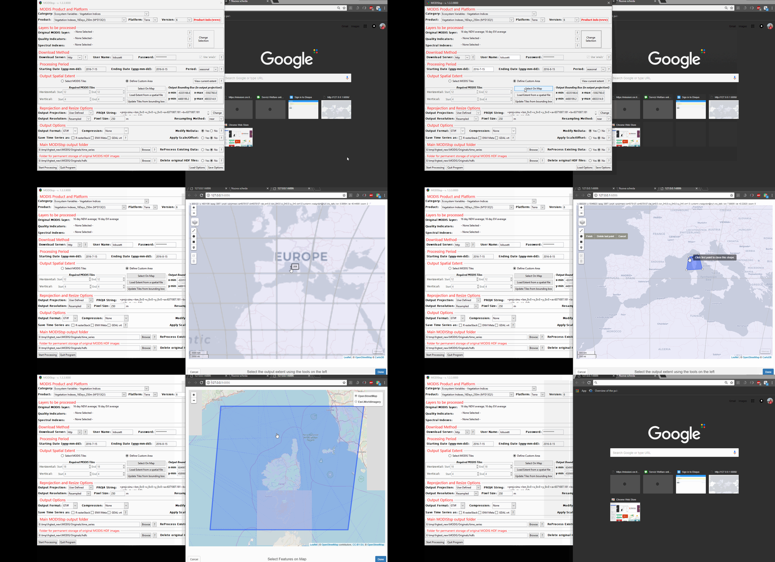
The new version introduces a strongly improved GUI (thanks mainly to @lwasser comments in her review for MODIStsp onboarding on ropensci). The new GUI facilitates the selection of layers to be processed, and allows interactive selection of the processing spatial extent over a map (thanks to @timsalabim and @timelyportfolio for implementing some changes on mapview to allow this!). The main changes introduced in the GUI are highlighted in the image and animation below:


Besides this, the main changes with respect to version 1.3.3 are related to:
- Inclusion of some new MODIS products;
- Removal of almost all v005 products, which were recently deprecated by NASA;
- Removal of FTP download functionality again due to deprecation from NASA;
- Improvement in functionality for dealing with NoData for products with multiple fill-values. If “Change NoData” is set to “Yes”, then in case a layer has multiple Nodata values all those values are set to NA in the output;
- Miscellaneous bug fixing and code refactoring.
The full changelog for v1.3.4 can be found HERE
We hope you will find the new version useful and that we didn’t introduce too many bugs ! Please report any problems in our issues GitHub page.